As we arose that morning, we realized 'this was it', our last chance to see anything near Moab that we might have missed. Another beautiful day. We had been getting daily weather reports from Ian's 10 year old son, when Ian called home each evening. The son had said it would cloud up today. Well, not yet, anyway.
We decided to ride out along the river west of town on the river's south side. It turned out to be spectacular, of course, but that was the norm, and a bit uninspiring. Bruce wanted to ride anything with a difficult 'D' marking on the map. Tom's back, my wrist, and Ian's good sense, put a kibash on that. We settle for tamer trails.
One place out there, there was a left turn that went through a gate. A sign said that there was a charge of a couple bucks per vehicle to go forth to attack a trail with a bunch of Double Ds on it. Nope not us.
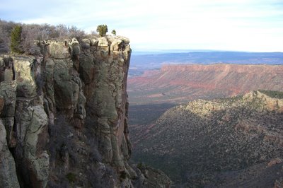
We drove along the river some 25 miles, ending up at 'Chicken's Corner'. No big deal,it was only awesome. We could see directly across the river to Deadhorse point. Deadhorse point was a State park about 2000 feet above us.
We could see a bit of an edifice on that big block of rock in that upper right hand corner of the above picture.
Must have been a big deal if you were up there looking south at us.
As Tom and I reflected on the meaning of deadhorse point, Ian and Bruce wanted to climb to the top of this cliff/rock. Scheesh kids....
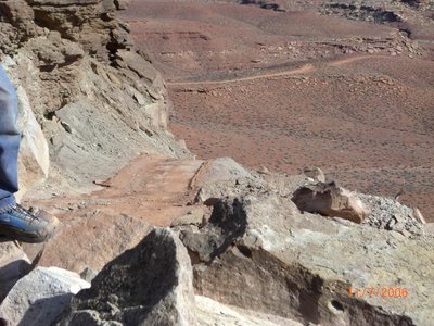
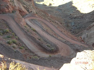
Well, it was about noon, we decided that we still wanted to see the Arches National Park, so we started back. I was trailing as usual, and the boys were keeping up a brisk pace. I expected Tom to slow it up, and claim that he wanted to smell the roses....But, no, he was feeling racy. A blistering pace along those cliff had me swallowing hard a few times as some of the cliff dropoffs flashed by, as we passed many of the tight switch backs on the way out. Exhilarating actually, since we had no incidents....but not too bright either. Ah, what the hell, 'you only live once', or 'luck beats good' is appropriate here......but still that emergency room at the hospital isn't busy for no reason.
On the way to town we stopped for a bit of 'Tomfoolery'. If you want to get someone to do something silly we found out that you only have to suggest it to Bruce. Ha.
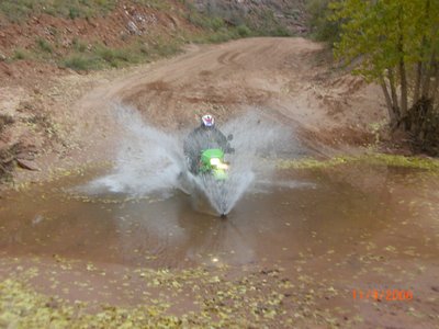
Soaked he was, after a couple runs through there to get the picture just right. Now don't get me wrong, Bruce is no idiot. His business does a couple million dollars worth of electrical contracting each year....but he's up for most anything, when there's some challenge to it. Like, for instance, the pool tournament that I damn near got us into the other night at the watering hole.....but that's another story.
I'm sure I could have led Bruce way astray, if I'd had more time with him when he was growing up. It wouldn't have helped him with his contracting business,...but he might have won a Baja race or two. LOL
The Arches National park is a 20 mile square piece of real estate that is unique from what we had seen before. By the time we had something to eat, and got out there we only had a couple hours of daylight left.
There is a lot of red cliffs that are somehow different from the others, and there are a dozen or more natural arches to see. Most require some walking to get close....and we only had time to see one up close. The rest would be from a distances as we drove by.
Tom walked out to this one while the rest of us went to 'Delicate Arch'. On the one mile walk he passed through this gap.
And another arch seen from the road.....
Here was my follie....The 'Delicate Arch'
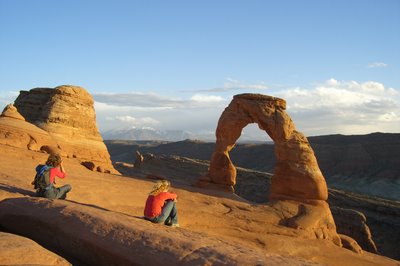
This was supposedly the best arch in the park. It's actually on Utah's license plate. It's over a mile and a half out there and back with a 500 foot rise in altitude.
I had foolishly said to Bruce and Ian, "Yeah, I'll walk up there with you". Tom was smarter, and knew his back wasn't up for it. So off the three of us went at a pretty good pace. I don't know what I was thinking right then, but shortly I was thinking that if I survive this, I would be more careful of what my big mouth was saying in the future.
After a 100 yrds of the hill, I was blowing hard. The boys let me rest. Then off again. I was surprised at what just a couple minutes of rest would do. And all in all I only had to rest about 5 or 6 times. Then 45 minutes later we rounded that last turn and there it was. Very inspiring.
There must have been 25 or more folks up there. Many in worse condition than I was. I got a picture to prove that I'd been there.
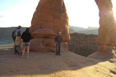
I was feeling pretty sassy, too.
We talked to many of the folks up there. Most of us felt a kinship for those that made it that far. The couple talking to Bruce, in the photo that I'm in, were riding a rental XL650R. She was from Spain. She was also going to be max cold when she rode back to town in those shorts.
The sun was going down and we left. On the way down the hill we were passed by a young gal who said 'hi' while going by. A bit of conversation flourished...where are you from and where are you camped and such. Turns out that this gal was traveling alone, and camping out of her Toyota pickup with a shell.
She hadn't picked a camp for the night yet, so we invited her to spend the night with us as a guest, to save a few buck. She turned out to be utterly delightful. She was in her early 20 and already graduated as a bugologist with a masters degree, and was traveling all over hell like this.
The only picture that we have of her is in the arch picture above with the two girls in it. She is the blond on the right.
She spent the evening at the campfire with us, and caused a pleasant change to our usual evening's conversation. She had been all over Baja, that made her a hit with me. I was pretty easy though. She said that her stuff was in LA Ca at her folks place, and the rest was in her Pickup. Very plucky girl, I admired her. I suppose my Lolita complex is showing. :)
It was a great last evening in Moab.
We arose early, loaded the bikes, said goodbys (to Brenda, as well), vowed to get together somewhere next year, and started the 13hr, 730 mile drive to Los Angeles.
I hate the end of a trip...........still, it really only signified the beginning of another, and reminded me to get busy planing for the future.
Funny story.........
A funny story, while on the ride home.........I-70 meets I-15 in Ut. It is a long stretch without gas. We passed a guy pushing his Harley over the top of a 6000ft summit on I-15 just south of the junction. I know there is no gas for at least 15 miles as I'm planning to get gas at the next opportunity, and I know where it is.
I tell Tom, (who's driving) to pull over and let's see what is really wrong with this guy. We have to walk back 100 yards to the guy, and Tom carried the gallon of gas that we had, just in case.
The guys says, as we approach, that he thinks he's out of gas, and that if that is gas in the can that Tom is carrying, that he will trade for it by granting us any three wishes..... He says that he was hoping that there was a station at the bottom of the hill. The guy was 50+ years old and really blowing when we got to him.
Anyway, another 5 minutes and his Harley was making loud, happy noises again. He was tickled to death, and wanted to pay or something.
I told him about being saved, while riding my motorcycle from Maine to San Diego, from a flat tire incident the month before out in Brenham, Tx, and that his bill was paid in advance by a couple of Texans from the 'Southern Cruisers' motorcycle list.
Saturday, November 18, 2006
Friday, November 17, 2006
Moab, the La Sal Mtn part, #6
We had gotten into the pattern of having breakfast at Denny's in town. Now I, as well as Tom had injuries to discuss. Tom's injuries had settled down to the point of only the long term stuff remaining.
He swore that he couldn't tell his wife or he would never be allowed to go again. And after a couple days his back and kidney area showed no signs of black and blue. He might just get away with it.
My wrist was already showing purple on the underside. It wasn't as sore today as last night. I could pull the clutch lever in for stopping and starting.
I've learned over the years that clutch cables on dirt bikes are a weak point. I never had one on a street bike, so I don't know about that. But I have broken two on my DR. Old Man Bud told me to quit using the clutch, dummy.
I read a trip report last month of a 4 bike dualsport ride down to Mexico. I think three of the guys lost a clutch cable. Well prepared guys have a spare cable strapped to the cable being used in order to do a quick fix.
Anyway clutchless shifting can cut your clutch usage down about 95 percent. Which means it will prolly last the life of the bike. It takes a little practice, but it doesn't take long to get onto it.
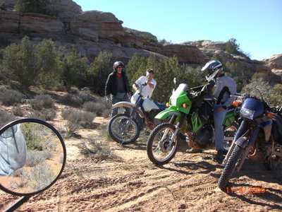
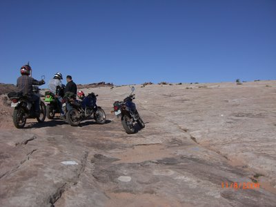
So today we decide to go out to some ATV/jeep trails northeast of town. The above picture is of a slickrock area. Not 'THE' slickrock area. There is another just east of Moab. Much bigger and red and famous with the bicyclers.
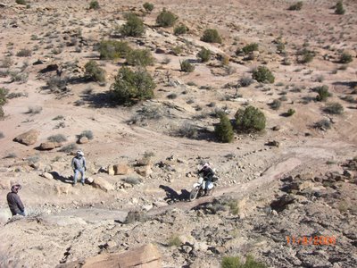
They seem to think that these area were sand dunes that solidified for some reason. We rolled up on this one and couldn't see where the trail went from there. So we rode out on it until we spied a 2-track leading away off to the left. There was a bit of an abrupt hill Leaving that slickrock that I was the only one to screw up on.
It was short and steep. I hit it a little too fast (I think), and was
thrown off balance.....that led me to a rock ledge that I didn't want
to hit. Oh....I don't know....it got kinda confusing after that. The
sore wrist wasn't helping any. The bike fell over. My wash detergent
gas cap (lost the real gas cap in Alaska) came off, I lost about a
gallon of gas before I could get the bike up.
The rest of the guys just rode right up. All the rest of my over confidence was gone by now. Pretty much was just fighting for survival at this point. :)
Speaking of over confidance. A little earlier we had all rode up to a dead end, above pic. We were having a powwow. I got off my bike on the right side, so I was trying to get the kickstand down, then found out that it wouldn't prop the bike up in the sand. So....whatever....I had to take a step backward, and got my foot tangled in a weed. Me and the bike fell on my ass right there.
So the above picture is me and Bruce straightening my freshly bent handle bar. Scheesh. Two days ago I was a star, and today I needed to be retrained.
We went another mile and Tom got caught on a short rutted climb in the wrong gear. The bike stalled, Tom need support on the long side, his leg didn't reach the ground. WHAM, or BANG.
So here is that hill. We got Tom's mess all cleaned up and I decided to get Bruce to take my bike up. He made it look so easy that I was embarrassed.
We had been out in this area for nearly 2 hours, fighting a bunch of deep sand and trails that weren't well marked. We decide to go back to town for a burger, and then go do the La Sal Mtn Loop which was Southeast of town.
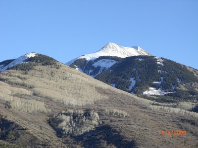
That's Mt Peale (Part of the La Sal Mtns)up there, 12xxx ft or so. We set out on the paved La Sal Mtn loop. It's only 50 miles or so....but local maps showed that there was a La Sal Mtn Pass. A dirt road that went across the hill to Paradox.
The dirt bikes are a blast on the tight twisties. We stopped at a tourist pull out with a large area sign map. We learned where the La Sal pass road was. There was an old gal there in a late model sedan. Like a grandmother waiting to pick up kids. I figure she might be a bit nervous with a biker gang pulled up next to her.
I started a conversation. She was 75 or 80 years old if she was a day. I asked if the La Sal pass was advisable. She said she wouldn't advise it as we could get bogged down in the mud. They had had a lot of rain in October....and she didn't know if we could get through the snow at the top. I thought yeah, yeah what did she know.
We found the road, and the kids talked us into trying to make it. Up an up we went. Beautifully clear scenes were in every direction that we looked. In just a few miles we were picking up snow on the shadow side of the hills.
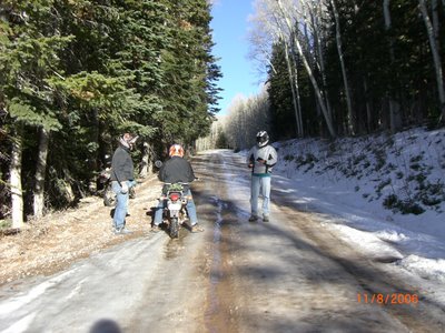
Not long afer that we were seeing snow on the road. It was packed down and looked a bit like slush. Tom misread one of these packed ice areas.
WHAM or POW was appropriate there. He went down and slid about 20 ft. Oh....and that 3rd mirror was history. Although Tom saved the glass, and we thought he could glue it back in the housing, so all was not lost. Tom packed the mirror away for safe keeping.
We made it another 1/4 of a mile. The going was slippery, and together with what a jeeper, coming down the hill, said, we decided to give up on the La Sal Pass. Turns out the old lady was spot on in her estimation. One for the old lady, biker gang zero.
So Back to carving up the paved road. We really enjoyed that, truthfully we didn't really need any more dirt bumpy roads. As the sun was setting, we got a few more great photos on the way through Castle valley.
Night was closing in on us as we hit the Colorado River Road. We had 10 mile to go. The kids lit out like scalded dogs. Tom wanted to take it easy, and enjoy the shadows on the cliffs. I followed, We were pretty much at peace with the world. As we toodled along something fell off of Tom's bike and shattered into a thousand pieces.....so much for saving that third mirror.
Tomorrow is the last day.............
Thursday, November 16, 2006
Moab, White Rim Trail...Part 5
That's Bruce on the left. I've not said much about Bruce. He's a great guy, and has turned out to be a damned good rider. He has a fire breathing 426cc Yamaha that he plays with at the ORV parks in Ohio.
He hates being on the NX when in the company of other riders on their motocross bikes. He prolly could out ride all of them, but image is everything out there. It's not what you can do, it's what you look like you can do. LOL
But anyway we all learned that if you don't think you can get up the hill, just have Bruce take it up for you. A rider like that is good to have along. The trouble with the 'have Bruce take it up for you' idea is that you didn't know you couldn't do it till it was too late.
So we got up extra early to do the White Rim Trail today. I've been hearing about this ride for 10 years. It's about 100 miles of trail around the west side of Canyon Land Natl Park. It's done from the high ground above the Colorado and Green rivers, so you always have a view, and the trail usually has a cliff nearby, sometimes too nearby.
It's a 100 miles of trail and 50 miles to and from. The NX's get 140 miles to a tank, and I don't know how far I can go. We needed to pack extra gas. Bruce bungied on a gallon and I toted 2 gallons. That would be plenty. The KLR had 6 gallons which was twice what he needed. He was getting about 50 mpg.
It was kinda nippy when we hit the pavement. "Don't hate me because of my electrics", I would tell the guys. :) But by 9am the temp was tolerable, and we had slowed for the dirt trail, and, really, it was just right. Actually, we were blessed with good weather the whole week.
We started the 100 mile trail at 9am. If we averaged 20 mph, it would be 5hrs. Local info said 6 to 8 hrs by MC.....hummmmm. Seems that we should keep an eye on the time we were taking. It was pretty easy to ride at 20mph, but averaging in the sight seeing and camera time was the problem. after 20 miles it seemed that we were making a 10 mph average. That would put us in after dark. Not a good thing.
That was Mussleman Arch...looked more like a bridge to me, anyway it was way cool with hundreds of feet below. Out there in the middle, it was a bit spooky.
Bruce was leading at this time. Somewhere along here Bruce's gas can had slide off it's rack and was dangling by a Bungy. A lesson is to get the spare gas in a gas tank as soon as there is room for it. Too many bad things can happen to extra gas.
Bruce and Tom were able to use the whole gallon between them. I envied there 75mpg mileage. Over the years I have learned that tying/bungying liquids onto a dirt bike may be one of the most underestimated tasks in existence.
Secretly I was pretty tickled that the eight bungies I had on my two gallon can was holding. Apparently, I have learned something from my years in Baja.
On we went, site after site, it was all spectacular.
So we are rolling along trying to pick up the pace when Bruce begins to smell something peculiar. Turns out he has lost his radiator cap. I hoped that it got caught in his fairing somewhere, but that wasn't the case. He decided to hop on Tom NX and see if he could find it.
We waited.....and a view in the other direction produced............
Soon he was back with the cap. Life was good and we were rolling again. Somewhere along here in the forty mile range, I had stopped for a picture. I was last in line, so I was trying to catch up. I crested a 6 or 8 foot rise. The trail made a left turn and I was lined up on the right track/rut. I was on the wrong slope of that rut if I had to turn left.
I won't say what happened next couldn't have been avoided.....but attempting the left turn just then did have an adverse effect. The front tire didn't bite. It slide out, and in a Madden voice "Bam" I was on the ground in a classic face plant.
I hit so hard,I remember wondering, "why am I still conscious?.....But I was. The bike was leaking a bit of gas, so I hurriedly lifted the bike. Oh, that hurt some. My left wrist was demanding some consideration, in fact, 'OUCH, dammit'. Remember me talking about over confidence. Well, that was all gone now.
I seemed to be able to ride ok. The wrist was pretty good in a straight push or pull, but any side pressure was bad. So a little sprain could be lived with...I guess. I caught up with the boys as they took a brake at the top of one of the hills.
Everybody that come along here must stop on top here. The hill was several hundred feet tall, and quite steep. A piece of equipment had been out there doing some work on the trail. It wouldn't have been passable by most of the vehicle (or me) if they didn't take care of about 4 hills on the trail at different places.
This was truly BFE, but these two crows had learned that they could bum a few scraps off of the tourist.
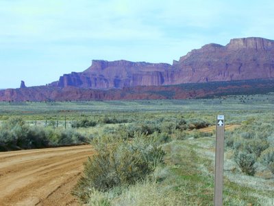
As we sat there taking a break a bicycle rider came along. There were three more bikes and a Toyota pickup in his group. These guys are nuts.....but who am I to talk. Bicycles usually take three days to make the loop. He was coming at us, so we asked him what was ahead. We were a little antsy about how much farther we had to go. It was already past 1pm.
He said we had about 35 more miles of trail. I figured that he probably was very accurate with mileage. If I was pedaling, I would know exactly how far I had come, and as it turned out he was exactly right.
We Picked up the Green River in another 10 miles, and stopped for pictures.
The bicycle rider had told us that there was a hell of a climb at the end of our ride. We came to a couple pretty big climb but at the wrong distances. They were again groomed, and I couldn't imagine how bad it would be without the road work. We didn't get pictures of those hills because we had our hands full riding.
Eventually we came to the 'BIG' hill. The road had turned to two lane by then, and was well graded, but it provided quite a few awesome pictures. Here are a few.
Once on top of that hill, we were home free. We had 25 miles of good gravel and paved roads to do before we could get gas. As we traveled those miles, I did a bit of philosophizing. I've never figured out if there is sound in a forest if no one is there to hear it.
Well, by the same token, I wondered if my face plant had possibly not really happened if my co-riders weren't there to see it. My wrist had stiffened up and was hurting like hell, but I hadn't actually cried in front of anyone. Maybe they didn't have to know about it at all.
We were getting gas, and I hadn't decided just exactly how to handle this phylosophical question, when bright eyed Tom says, "say, Pete, what happened to that tail light lense. Did you get off out there?"
Well, I knew I'd been had, but I was certainly not going to be able to keep that get off a secret now. I had just been wondering, that's all.
I'll tell you what, though, With my injured wrist, I had a whole lot more understanding about what Tom had been going through with his bad ribs and back and all.
Once we got back to camp we all enjoyed a beverage .....a couple of tall boys was just what the doctor ordered.
Of note is the fact that Tom borrowed one of Bruce's 2 good mirrors and still had it at the end of the day.
Wednesday, November 15, 2006
Moab to Gateway Co...Part 4
We all (not Tom) got up the next morning, started a fire, had coffee and waited for word from Tom. He had been a sore puppy the night before, and we didn't really expect any miracles to happen overnight.
Eventally, he moaned his way out of the tent, and announced that he would just hang around camp today. He limped his way into the van for a ride to breakfast, though.
we usually used breakfast in town as a reason to let the sun warm things up to rideable temperatures, and then around 10am we would start out for a daily exploration. Today we were going to ride out Onion Creek road, which would skirt the east side of the La Sal Mountains, and travel into Western Co. We hoped to end up at Gateway Co.
When we saw the above scene, we began to suspect that we were in for something special. OC Road wound along a wet wash for about 10 miles. The canyon was narrow, and there was a small water crossing every 1/4 mile or so.
The road was not challenging, which was fine. We were happy just drinking in the ever different canyon walls. We eventually popped out in a high valley. Walker Ranch was up ahead, one of the many working ranches of the west.
When we arrived at a cross roads near the ranch, as we debated where to go, an old rancher and his wife came by in a pickup. When I say old, I mean old. Late Seventies, I'd suspect. We waved them down, and asked directions. They said the road we were on only went to the ranch, but the fork to the left would take us to Gateway.
They were a bit tentative when they said 'take us to Gateway'. I wondered why. Turns out there were many other turns required to get us to Gateway. We didn't really care. We had time and gas, and the country was inspiring.
One wrong turn took us in the direction that we wanted to go, but dead ended us at about 7000ft at an old defunct mine. We wandered around there for nearly an hour, trying to put some sense to the situation.
We left the mine wondering about the men that worked their hearts out up on that Mountain. I postulated that a bored rich easterner met a prospecter in a bar in Grand Junction somewhere around the '30s. Over a few drinks the westerner convince the easterner that he had found gold in some mountains near there, but didn't have the financial where-with-all to go and get it.
A few more drinks and some handshakes, and a parternship was born. I don't imagine anyone made a profit, but I thank them both for the roads that were made way back then that allowed us to spend a little time on the top of the world up there.
We left the mine with a plan. We had seen a sign 10 miles back that said 'Gateway Road' with an arrow indicating the way that we didn't go. We would take that after we got down off this hill.
Soon we were on Gateway road, which took us down John Brown Canyon. JBC is a 15% to 20% down hill dirt road for about 5 miles as you ride into Gateway, spectaclar all by itself. Gateway has a new tourist Mall that has nearly put old Gateway out of business. No more cafe and gas station in the old town. Progress, I suppose. We looked for the old stuff, but had to settle for clerks in the new mall who didn't add much flavor to the day.
We gassed up and had a sandwich. It was now 3:30, and we had to hustle to get back before dark. We found the direct route to be only 55 miles long with 30 miles of pavement through Castle Valley. We passed a few vistas.
I surely enjoyed having my home built electric shirt on for the trip home. When the sun went behind a canyon wall, the chill started it's work immediately.
Soon we were in camp with an evening fire already started by Tom who had worked all day gluing his bike back together. Fine job he did too.
But real men............don't mess with no stinking tent. :)
Tom said that he was feeling better than last night, and anticipated being able to ride tomorrow. We had planned to ride the 'White Rim Trail' tomorrow. That turned out to be 80 miles of trail, and 70 miles of pavement. It would turn out to be a hard day.
Subscribe to:
Posts (Atom)